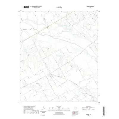
2019 Map of Emhouse
USGS Topo · Published 2019About this map
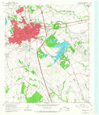
Chambers Creek meanders southeast across this Navarro County landscape, shaping the geography between the settlements of Emhouse and Rice. The terrain is defined by a dense network of hydrologic features, including the Waxahachie Slough and a series of numbered water bodies such as Reservoir Number One Hundred Twentyone. This 2019 survey documents a rural Texas environment where historical sites like Pattison Cem remain preserved alongside modern infrastructure. The map illustrates a transition from the rolling drainage basins of Big Onion Cr and Cummins Cr to the more developed outskirts of Corsicana in the southern portion. Local land use is further indicated by Coyote Field, while the county boundary between Ellis and Navarro counties cuts diagonally across the northern reaches, marking the political and physical divide of the Blackland Prairie region.
Find a feature on this map
85 named features on this map. Tap any name to fly to it.
Don’t see what you’re looking for? This feature index may not catch every label — zoom into the map to look around manually.
Map Details
Editions of this 2019 Emhouse Map
This is the sole edition of this map. No revisions or reprints were ever made.
Other maps of this area

1954 · Dallas
USGS Topo · 1:250,000
1956 · Ennis
USGS Topo · 1:62,500

1958 · Dallas
USGS Topo · 1:250,000
1961 · Chatfield
USGS Topo · 1:24,000
1962 · Emhouse
USGS Topo · 1:24,000
1962 · Ennis West
USGS Topo · 1:24,000
1962 · Ennis East
USGS Topo · 1:24,000
1962 · Rosser SW
USGS Topo · 1:24,000
1962 · Cryer Creek
USGS Topo · 1:24,000
1965 · Corsicana
USGS Topo · 1:24,000