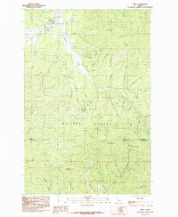
1985 Map of Emida
USGS Topo · Published 1985About this map
Emida serves as the primary settlement on this northern Idaho landscape, situated along the upper reaches of Santa Creek. The terrain is defined by the high elevations of the St Joe National Forest and the Hoodoo Mountains, which dominate the central and southern portions of the survey. A Lookout Tower positioned on one of these peaks indicates the importance of fire surveillance in this heavily timbered region.
Find a feature on this map
44 named features on this map. Tap any name to fly to it.
Don’t see what you’re looking for? This feature index may not catch every label — zoom into the map to look around manually.
Map Details
Editions of this 1985 Emida Map
This is the sole edition of this map. No revisions or reprints were ever made.
Other maps of this area

1955 · Pullman
USGS Topo · 1:250,000

1955 · Spokane
USGS Topo · 1:250,000

1957 · Emida
USGS Topo · 1:62,500

1958 · Spokane
USGS Topo · 1:250,000

1958 · Pullman
USGS Topo · 1:250,000

1961 · Deary
USGS Topo · 1:62,500

1961 · Fernwood
USGS Topo · 1:62,500

1961 · Bovill
USGS Topo · 1:62,500

1981 · St Maries
USGS Topo · 1:100,000

1981 · Potlatch
USGS Topo · 1:100,000