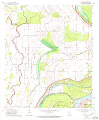
1970 Map of Eminence
USGS Topo · Published 1972About this map
Bayou Macon winds through the alluvial lowlands of Chicot County in this 1970 survey, defining a landscape shaped by the shifting hydrologies of the Mississippi River basin. The map documents the intricate network of water bodies such as Otter Lake, Weaver Bayou, and Moon Chute that characterize the Delta region. Settlement patterns are concentrated near established water routes and levees, with the community of Lakeport and the nearby Lakeport Cem serving as significant local landmarks. The presence of Indian Mounds near Harwood indicates a deep human history in this fertile bottomland long before the arrival of modern agriculture. The intricate boundary between Louisiana and Arkansas and Mississippi is traced along the river's path, highlighting the geopolitical complexity of the region. Researchers can also find local social anchors like the New Mizpah Ch and the North Star Cem, which offer essential data points for genealogical study in this corner of the South.
Find a feature on this map
24 named features on this map. Tap any name to fly to it.
Don’t see what you’re looking for? This feature index may not catch every label — zoom into the map to look around manually.
Map Details
Editions of this 1970 Eminence Map
2 editions found
Other maps of this area

1936 · Eudora
USGS Topo · 1:62,500

1936 · Lake Village
USGS Topo · 1:62,500

1939 · Readland
USGS Topo · 1:62,500

1939 · Refuge
USGS Topo · 1:62,500

1953 · Greenwood
USGS Topo · 1:250,000

1955 · Lake Village
USGS Topo · 1:62,500

1956 · Greenwood
USGS Topo · 1:250,000

1957 · Eudora
USGS Topo · 1:62,500
1970 · Glen Allan
USGS Topo · 1:24,000
1970 · Wayside
USGS Topo · 1:24,000