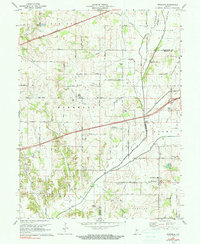
1970 Map of Eminence
USGS Topo · Published 1991About this map
Eminence and the crossroads of Belle Union anchor this central Indiana landscape as it appeared in the 1950s through 1970. The terrain is defined by a dense network of waterways including Mill Creek, Mud Creek, and Little Deer Creek, which historically shaped the placement of local infrastructure and community life. The presence of a Covered Bridge across Mill Creek highlights the traditional river crossings that once served these agrarian communities.
Find a feature on this map
35 named features on this map. Tap any name to fly to it.
Don’t see what you’re looking for? This feature index may not catch every label — zoom into the map to look around manually.
Map Details
Editions of this 1970 Eminence Map
2 editions found
Other maps of this area

1949 · Quincy
USGS Topo · 1:24,000

1953 · Clayton
USGS Topo · 1:24,000

1953 · Indianapolis
USGS Topo · 1:250,000

1955 · Hall
USGS Topo · 1:24,000

1956 · Indianapolis
USGS Topo · 1:250,000

1956 · Cloverdale
USGS Topo · 1:24,000

1956 · Cataract
USGS Topo · 1:24,000

1956 · Eminence
USGS Topo · 1:24,000

1957 · Indianapolis
USGS Topo · 1:250,000
1957 · Paragon
USGS Topo · 1:24,000