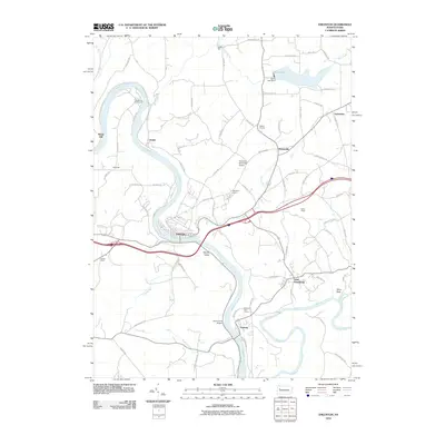
2010 Map of Emlenton
USGS Topo · Published 2010About this map
Emlenton occupies a sharp bend in the Allegheny River where the waterway winds through western Pennsylvania. This 2010 survey shows the tight coordination between the river corridor and regional transportation, as modern highways cross the valley near Sandy Point. The landscape is defined by the confluence of the Clarion River and the Allegheny, with the settlement of Foxburg positioned just north of the junction.
Find a feature on this map
79 named features on this map. Tap any name to fly to it.
Don’t see what you’re looking for? This feature index may not catch every label — zoom into the map to look around manually.
Map Details
Editions of this 2010 Emlenton Map
This is the sole edition of this map. No revisions or reprints were ever made.
Other maps of this area

1907 · Foxburg
USGS Topo · 1:62,500

1908 · Foxburg
USGS Topo · 1:62,500

1909 · Franklin
USGS Topo · 1:62,500

1910 · Hilliards
USGS Topo · 1:62,500

1911 · Franklin
USGS Topo · 1:62,500

1912 · Hilliards
USGS Topo · 1:62,500

1922 · Oil City
USGS Topo · 1:48,000

1924 · Oil City
USGS Topo · 1:62,500

1943 · Oil City
USGS Topo · 1:62,500

1944 · Hilliards
USGS Topo · 1:62,500