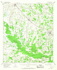
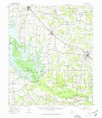
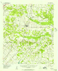
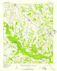
1956 Map of Emory
USGS Topo · Published 1968About this map
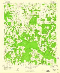
Lake Fork Creek and the Sabine River converge in this mid-century look at Rains County, defining a landscape of bottomlands and sloughs. Before major reservoir projects altered the local hydrology, the area around Emory and Point was a network of rural schoolhouse districts and small country congregations. The map documents the planned Iron Bridge Damsite, a critical marker of the coming transition from a river-and-creek economy to a lake-based one.
Find a feature on this map
102 named features on this map. Tap any name to fly to it.
Don’t see what you’re looking for? This feature index may not catch every label — zoom into the map to look around manually.
Map Details
Editions of this 1956 Emory Map
3 editions found
Other maps of this area

1953 · Texarkana
USGS Topo · 1:250,000

1954 · Dallas
USGS Topo · 1:250,000

1954 · Sherman
USGS Topo · 1:250,000

1956 · Texarkana
USGS Topo · 1:250,000

1956 · Tyler
USGS Topo · 1:250,000
1956 · Quinlan
USGS Topo · 1:62,500
1956 · Emory
USGS Topo · 1:62,500

1958 · Dallas
USGS Topo · 1:250,000

1958 · Sherman
USGS Topo · 1:250,000
1958 · Arbala
USGS Topo · 1:24,000