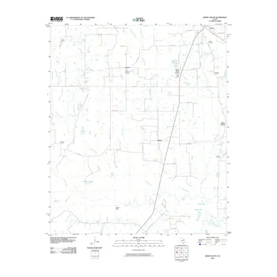
2010 Map of Emory South
USGS Topo · Published 2010About this map
Emory serves as the northern anchor for this Rains County landscape, which transitions from the developed edge of the town into a mosaic of rural settlements and bottomlands. Small communities like Smyrna, Dunbar, and Willow Springs are identified alongside numerous family and church burial grounds, including Woosley Cemetery and Clewis Cemetery. The topography is defined by the gradual drainage of Reeder Creek, Brushy Creek, and Sandy Creek as they move south toward the Sabine River.
Find a feature on this map
71 named features on this map. Tap any name to fly to it.
Don’t see what you’re looking for? This feature index may not catch every label — zoom into the map to look around manually.
Map Details
Editions of this 2010 Emory South Map
This is the sole edition of this map. No revisions or reprints were ever made.
Other maps of this area

1956 · Tyler
USGS Topo · 1:250,000

1956 · Emory
USGS Topo · 1:62,500

1958 · Arbala
USGS Topo · 1:24,000

1958 · Alba
USGS Topo · 1:24,000

1959 · Grand Saline
USGS Topo · 1:24,000

1959 · Grand Saline
USGS Topo · 1:62,500

1959 · Alba
USGS Topo · 1:62,500
1962 · Edgewood
USGS Topo · 1:24,000
1962 · Fruitvale
USGS Topo · 1:24,000
1980 · Emory North
USGS Topo · 1:24,000