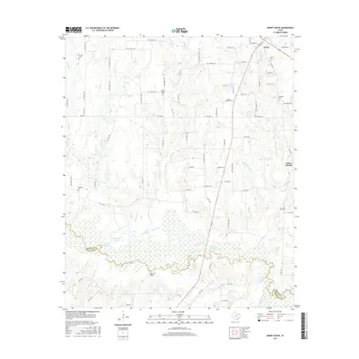
2016 Map of Emory South
USGS Topo · Published 2016About this map
The Sabine River forms a complex, meandering boundary between Rains and Van Zandt counties, defining the southern portion of this landscape. The river valley is characterized by numerous secondary waterways and wetlands, including Holcomb Slough, Yellow Steer Slough, and Little Slough, which weave through the lowlands near Martin Bluff. These features illustrate the hydrologic character of the region before further modern engineering might alter the natural drainage patterns of the river basin.
Find a feature on this map
86 named features on this map. Tap any name to fly to it.
Don’t see what you’re looking for? This feature index may not catch every label — zoom into the map to look around manually.
Map Details
Editions of this 2016 Emory South Map
This is the sole edition of this map. No revisions or reprints were ever made.
Other maps of this area

1956 · Tyler
USGS Topo · 1:250,000

1956 · Emory
USGS Topo · 1:62,500

1958 · Arbala
USGS Topo · 1:24,000

1958 · Alba
USGS Topo · 1:24,000

1959 · Grand Saline
USGS Topo · 1:24,000

1959 · Grand Saline
USGS Topo · 1:62,500

1959 · Alba
USGS Topo · 1:62,500
1962 · Edgewood
USGS Topo · 1:24,000
1962 · Fruitvale
USGS Topo · 1:24,000
1980 · Emory North
USGS Topo · 1:24,000