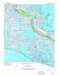
1960 Map of Empire
USGS Topo · Published 1967About this map
The Mississippi River defines the structure of this Plaquemines Parish landscape, with settlements and industries clinging to the narrow natural levees between the river and the marshy bays. Just before the 1960s, the era was characterized by the intensive expansion of the petroleum industry alongside traditional river life. Extensive infrastructure for the Potash Oil Field, Lake Washington Oil Field, and Cox Bay Oil Field is visible, alongside numerous pumping stations and towers that supported the extraction of resources from the wetlands.
Find a feature on this map
104 named features on this map. Tap any name to fly to it.
Don’t see what you’re looking for? This feature index may not catch every label — zoom into the map to look around manually.
Map Details
Editions of this 1960 Empire Map
2 editions found
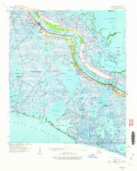
Other maps of this area

1891 · Pointe a La Hache
USGS Topo · 1:62,500

1892 · Quarantine
USGS Topo · 1:62,500

1892 · Pointe a La Hache
USGS Topo · 1:62,500

1893 · La Fortuna
USGS Topo · 1:62,500

1893 · Forts
USGS Topo · 1:62,500

1893 · Fort Livingston
USGS Topo · 1:62,500

1893 · Dime
USGS Topo · 1:62,500

1893 · West Delta
USGS Topo · 1:62,500

1935 · Port Sulphur
USGS Topo · 1:31,680

1935 · Bastian Bay
USGS Topo · 1:31,680