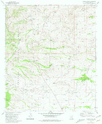
1981 Map of Empire Ranch
USGS Topo · Published 1981About this map
Empire Ranch serves as a focal point for this 1981 survey of the northern Sonoita Valley, an area defined by long-standing ranching operations and mining history. The map detail extends from the Empire Mountains in the northeast to the settlement of Greaterville in the southwest, where a Cem and local Gulch systems like Sucker Gulch and Ophir Gulch indicate the legacy of early mineral exploration. The rugged topography is deeply etched by significant drainage networks, including Davidson Canyon and Empire Gulch, which supported isolated outposts such as High Haven Ranch and Thurber Ranch. Within the Coronado National Forest, evidence of industrial activity remains at Rosemont Camp and the Helena Mine, while numerous water sources like Oak Tree Windmill and Maternity Well highlight the critical infrastructure required for life in this arid landscape.
Find a feature on this map
50 named features on this map. Tap any name to fly to it.
Don’t see what you’re looking for? This feature index may not catch every label — zoom into the map to look around manually.
Map Details
Editions of this 1981 Empire Ranch Map
3 editions found
Other maps of this area

1904 · Patagonia
USGS Topo · 1:125,000

1905 · Patagonia
USGS Topo · 1:125,000

1922 · Agus Caliente
USGS Topo · 1:62,500

1926 · Helvetia
USGS Topo · 1:62,500

1932 · Elgin
USGS Topo · 1:62,500

1940 · Elgin
USGS Topo · 1:62,500

1947 · Elgin
USGS Topo · 1:62,500

1948 · Elgin
USGS Topo · 1:24,000

1948 · Sonoita
USGS Topo · 1:24,000

1956 · Nogales
USGS Topo · 1:250,000