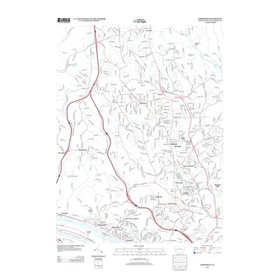
2013 Map of Emsworth
USGS Topo · Published 2013About this map
Emsworth and its neighbors along the Ohio River corridor anchor this 2013 survey of suburban Pittsburgh's northwestern reaches. The map illustrates a landscape shaped by both the river and the modern infrastructure of Interstate 79 and US Highway 19, which link older established boroughs like Ben Avon and Avalon to the northern settlements of Wexford and Ingomar. Notable landmarks like Neville Island and the Back Channel define the southern edge, while the interior is a complex web of residential developments and green spaces, including North Park Golf Course and Green Valley Golf Course. The map provides excellent detail for those tracing the development of local neighborhoods, showing the precise footprints of communities such as West View, Laurel Gardens, and Highcliff alongside natural features like Lowries Run and Pine Creek.
Find a feature on this map
55 named features on this map. Tap any name to fly to it.
Don’t see what you’re looking for? This feature index may not catch every label — zoom into the map to look around manually.
Map Details
Editions of this 2013 Emsworth Map
This is the sole edition of this map. No revisions or reprints were ever made.
Other maps of this area

1904 · Mc Keesport
USGS Topo · 1:62,500

1904 · Carnegie
USGS Topo · 1:62,500

1906 · Carnegie
USGS Topo · 1:62,500

1906 · Sewickley
USGS Topo · 1:62,500

1907 · Pittsburg
USGS Topo · 1:62,500

1908 · Sewickley
USGS Topo · 1:62,500

1908 · Carnegie
USGS Topo · 1:62,500

1908 · New Kensington
USGS Topo · 1:62,500

1910 · New Kensington
USGS Topo · 1:62,500

1948 · Pittsburgh West
USGS Topo · 1:24,000