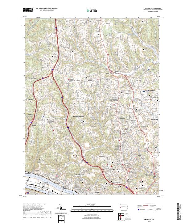
2023 Map of Emsworth
USGS Topo · Published 2023About this map
Emsworth and its surrounding boroughs occupy a critical bend in the Ohio River, where the Three Rivers Water Trail winds past Neville Island. The landscape is characterized by a dense network of suburban developments and residential communities like Franklin Park, Ben Avon Heights, and West View, connected by thoroughfares such as Rochester RD. This area reflects a deep-rooted community history, evident in the high concentration of religious and institutional landmarks, from the campus of La Roche College to the numerous parish cemeteries like Saint Johns Lutheran Cem and Saint Teresa of Avila Cem. Notable for local historians is the African-American Military Cem near Girty Run, alongside several legacy sites including the Dixmont State Hospital Cem. The map illustrates how the rugged drainage of Pine Creek and Lowries Run has shaped the expansion of North Hills settlements like Wexford and Ingomar.
Find a feature on this map
236 named features on this map. Tap any name to fly to it.
Don’t see what you’re looking for? This feature index may not catch every label — zoom into the map to look around manually.
Map Details
Editions of this 2023 Emsworth Map
This is the sole edition of this map. No revisions or reprints were ever made.
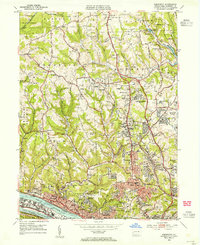
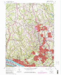
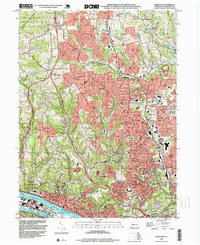
Historical Maps of Ingomar Through Time
4 maps found