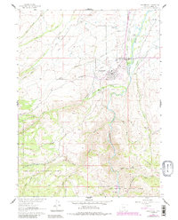
1961 Map of Encampment
USGS Topo · Published 1984About this map
Encampment and its neighboring town of Riverside serve as the focal points for this high-altitude landscape where the Sierra Madre Mountains meet the valley floor. The settlement pattern here reflects a classic Western ranching and resource economy, with established properties like the Wirz Ranch, Peryam Ranch, and Oldman Ranch dotting the irrigated lands. Irrigation is central to the area's development, evidenced by an intricate network of waterways such as the Cherokee Ditch, Pacific Valley Ditch, and Wagoner Enlarged Ditch, which redirect the flow of the Encampment River.
Find a feature on this map
47 named features on this map. Tap any name to fly to it.
Don’t see what you’re looking for? This feature index may not catch every label — zoom into the map to look around manually.
Map Details
Editions of this 1961 Encampment Map
5 editions found
Other maps of this area

1939 · Saratoga
USGS Topo · 1:125,000

1954 · Rawlins
USGS Topo · 1:250,000

1958 · Rawlins
USGS Topo · 1:250,000

1961 · Red Mountain
USGS Topo · 1:24,000

1961 · Gunst Reservoir
USGS Topo · 1:24,000

1961 · Encampment
USGS Topo · 1:24,000
1961 · Blackhall Mountain
USGS Topo · 1:24,000
1961 · Dudley Creek
USGS Topo · 1:24,000
1961 · Cow Creek Ranch
USGS Topo · 1:24,000
1961 · Cow Creek
USGS Topo · 1:24,000