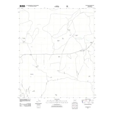
2011 Map of Encinoso
USGS Topo · Published 2011About this map
Encinoso stands as the primary settlement in this high-altitude landscape of Lincoln County, where the transition from open range to the steep slopes of West Mountain is defined by a network of ranching estates. The map documents long-established landholdings such as Block Ranch, Koprian Ranch, and Merchant Ranch, reflecting a legacy of large-scale cattle operations in central New Mexico. Water remains the critical factor for these high-desert settlements, indicated by the importance of Macho Spring and Gum Spring along the intermittent drainage of Carrizo Creek.
Find a feature on this map
30 named features on this map. Tap any name to fly to it.
Don’t see what you’re looking for? This feature index may not catch every label — zoom into the map to look around manually.
Map Details
Editions of this 2011 Encinoso Map
This is the sole edition of this map. No revisions or reprints were ever made.
Other maps of this area

1934 · Capitan
USGS Topo · 1:48,000

1935 · Capitan Mountains
USGS Topo · 1:48,000

1937 · Capitan
USGS Topo · 1:62,500

1940 · Capitan Mountains
USGS Topo · 1:62,500

1955 · Roswell
USGS Topo · 1:250,000

1958 · Roswell
USGS Topo · 1:250,000

1962 · Roswell
USGS Topo · 1:250,000

1973 · Jacob Spring
USGS Topo · 1:24,000

1973 · Jicarilla Peak
USGS Topo · 1:24,000
1973 · Capitan
USGS Topo · 1:24,000