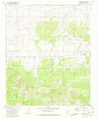
1981 Map of Encinoso
USGS Topo · Published 1981About this map
Encinoso sits at the gateway to the high elevations of the Lincoln National Forest, where the ranching culture of Lincoln County meets the northern slopes of the Capitan Mountains. This 1981 edition documents the transition from open grazing land to the steep canyons of the national forest, marked by historic points of interest such as the Las Tablas site and its associated Las Tablas Spring. The landscape is defined by its water sources and livestock infrastructure, featuring numerous water tanks and named springs like Macho Spring and Gum Spring. Settled life is represented by the Block Ranch, a Cem (cemetery), and a Landing Strip, illustrating the logistical needs of remote New Mexico ranching and resource management. The map's detail extends into the complex drainage systems of Arroyo del Macho and Carrizo Creek, which cut through the limestone and igneous terrain typical of this mountain range.
Find a feature on this map
32 named features on this map. Tap any name to fly to it.
Don’t see what you’re looking for? This feature index may not catch every label — zoom into the map to look around manually.
Map Details
Editions of this 1981 Encinoso Map
This is the sole edition of this map. No revisions or reprints were ever made.
Other maps of this area

1934 · Capitan
USGS Topo · 1:48,000

1935 · Capitan Mountains
USGS Topo · 1:48,000

1937 · Capitan
USGS Topo · 1:62,500

1940 · Capitan Mountains
USGS Topo · 1:62,500

1955 · Roswell
USGS Topo · 1:250,000

1958 · Roswell
USGS Topo · 1:250,000

1962 · Roswell
USGS Topo · 1:250,000

1973 · Jacob Spring
USGS Topo · 1:24,000

1973 · Jicarilla Peak
USGS Topo · 1:24,000
1973 · Capitan
USGS Topo · 1:24,000