
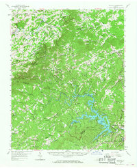
1957 Map of Endicott
USGS Topo · Published 1959About this map
Philpott Reservoir dominates the southern landscape of this Virginia survey, where the Smith River snakes through the borderlands of Patrick, Franklin, and Henry counties. The creation of the reservoir transformed the local topography, yet the surrounding ridges maintain a dense network of upland settlements and social centers. Academic and spiritual life is anchored by Ferrum Jr College in the northeast and numerous rural congregations like Stonewall Churches, Harris Cannaday Ch, and the Phoebe Needles Memorial Sch. Along the high western ridge, the Blue Ridge Parkway provides access to Smart View Park, while the lowland areas near Fairy Stone State Park reflect the region's recreational and timber character. The Norfolk and Western railroad skirts the eastern edge, serving established communities like Ferrum and Prillman as they transition toward the industrial center of West Bassett.
Find a feature on this map
99 named features on this map. Tap any name to fly to it.
Don’t see what you’re looking for? This feature index may not catch every label — zoom into the map to look around manually.
Map Details
Editions of this 1957 Endicott Map
2 editions found
Other maps of this area

1890 · Roanoke
USGS Topo · 1:125,000

1890 · Christiansburg
USGS Topo · 1:125,000

1891 · Roanoke
USGS Topo · 1:125,000

1924 · Martinsville
USGS Topo · 1:48,000

1925 · Rocky Mount
USGS Topo · 1:48,000

1926 · Martinsville
USGS Topo · 1:62,500

1926 · Critz
USGS Topo · 1:48,000

1927 · Rocky Mount
USGS Topo · 1:62,500

1927 · Martinsville
USGS Topo · 1:62,500

1928 · Stuart
USGS Topo · 1:48,000