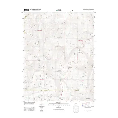
2013 Map of Engineer Mountain
USGS Topo · Published 2013About this map
Engineer Mountain dominates the high-altitude landscape where the boundaries of San Juan and La Plata counties meet. This 2013 survey documents a region defined by recreational development and transit, centered on the corridor of the Million Dollar Hwy. In the southern portion of the map, the Purgatory Ski Area and Purgatory Campground signify the area's modern identity as a destination for outdoor enthusiasts. The map preserves the locations of established residential and utility sites like the Cascade Summer Home Group and Harris Ranch. Extensive trail networks, including the Rico - Silverton Trail / Colorado Trail 507 and Engineer Mountain Trail 508, weave through San Juan National Forest, connecting high peaks such as Grayrock Peak with alpine water bodies like Potato Lake and Scout Lake.
Find a feature on this map
55 named features on this map. Tap any name to fly to it.
Don’t see what you’re looking for? This feature index may not catch every label — zoom into the map to look around manually.
Map Details
Editions of this 2013 Engineer Mountain Map
This is the sole edition of this map. No revisions or reprints were ever made.
Other maps of this area

1897 · Telluride
USGS Topo · 1:62,500

1897 · Silverton
USGS Topo · 1:62,500

1898 · Engineer Mountain
USGS Topo · 1:62,500

1900 · Engineer Mountain
USGS Topo · 1:62,500

1900 · Needle Mountains
USGS Topo · 1:62,500

1901 · Silverton
USGS Topo · 1:62,500

1902 · Needle Mountains
USGS Topo · 1:62,500

1902 · Silverton
USGS Topo · 1:62,500

1904 · Telluride
USGS Topo · 1:62,500

1908 · Engineer Mountain
USGS Topo · 1:62,500