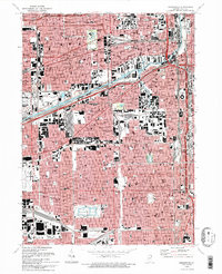
1993 Map of Englewood
USGS Topo · Published 1993About this map
Englewood and the southwest side of Chicago appear as a dense urban grid in this early 1990s survey, defined by its historic industrial corridors and educational institutions. The landscape is cleaved by the Ship and Sanitary Canal and the South Branch Chicago River, which meet at the Turning Basin. This waterway infrastructure, paired with the expansive Chicago Midway Airport at the western edge, underscores the area's role as a transportation hub.
Find a feature on this map
149 named features on this map. Tap any name to fly to it.
Don’t see what you’re looking for? This feature index may not catch every label — zoom into the map to look around manually.
Map Details
Editions of this 1993 Englewood Map
2 editions found
Other maps of this area

1889 · Chicago
USGS Topo · 1:62,500

1890 · Des Plaines
USGS Topo · 1:62,500

1891 · Chicago
USGS Topo · 1:62,500

1891 · Riverside
USGS Topo · 1:62,500

1892 · Calumet
USGS Topo · 1:62,500

1893 · Calumet
USGS Topo · 1:62,500

1893 · Riverside
USGS Topo · 1:62,500

1894 · Des Plaines
USGS Topo · 1:62,500

1900 · Chicago
USGS Topo · 1:62,500

1900 · Des Plaines
USGS Topo · 1:62,500