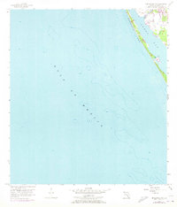
1957 Map of Englewood NW
USGS Topo · Published 1973About this map
Manasota Key forms a slender protective barrier between the open Gulf of Mexico and the shallow, sheltered waters of Lemon Bay. This mid-century survey, updated with 1970s aerial photography, reveals the coastal morphology of the Florida shoreline before extensive modern development. The map details the transition from the gulf's depths to the intricate shoreline of the mainland, where Forked Creek empties into the bay. Significant for those studying the evolution of Florida's waterfront, the sheet includes a designated Trailer Park and early roads that hint at the region's burgeoning appeal as a residential and recreational destination. The bathymetric contours throughout the bay and gulf provide a clear view of the underwater topography that defined local navigation and fishing during this period.
Find a feature on this map
5 named features on this map. Tap any name to fly to it.
Don’t see what you’re looking for? This feature index may not catch every label — zoom into the map to look around manually.
Map Details
Editions of this 1957 Englewood NW Map
3 editions found
Other maps of this area

1944 · Myakka River
USGS Topo · 1:31,680

1944 · Venice
USGS Topo · 1:31,680

1956 · Englewood
USGS Topo · 1:24,000

1956 · Tampa
USGS Topo · 1:250,000

1956 · Charlotte Harbor
USGS Topo · 1:250,000

1957 · Englewood NW
USGS Topo · 1:24,000

1957 · Placida
USGS Topo · 1:24,000

1959 · Tampa
USGS Topo · 1:250,000

1960 · Tampa
USGS Topo · 1:250,000

1972 · Tampa
USGS Topo · 1:250,000