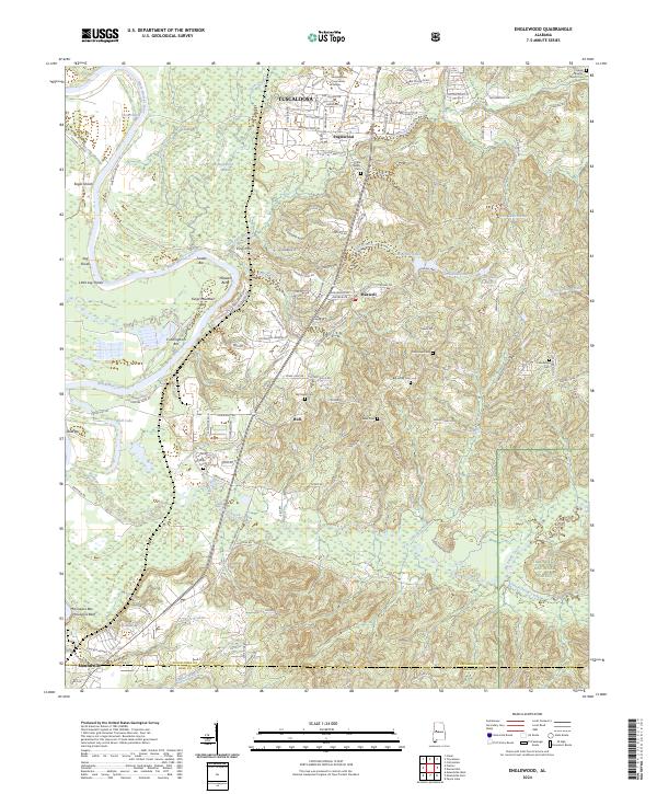
2024 Map of Englewood
USGS Topo · Published 2024About this map
Shelton State Community College and the southern reaches of Tuscaloosa anchor the northern edge of this landscape, where the urban fringe meets the winding Black Warrior River. The river's course is marked by numerous navigational features, including Maxwell Bend, Eagle Shoals, and Cunningham Bar, reflecting the area's importance as a riparian corridor. Moving south, the terrain transitions into the dense woodlands of the Talladega National Forest, punctuated by a network of rural settlements such as Hull, Englewood, and Maxwell.
Find a feature on this map
115 named features on this map. Tap any name to fly to it.
Don’t see what you’re looking for? This feature index may not catch every label — zoom into the map to look around manually.
Map Details
Editions of this 2024 Englewood Map
This is the sole edition of this map. No revisions or reprints were ever made.
Other maps of this area

1899 · Brookwood
USGS Topo · 1:125,000

1924 · Tuscaloosa
USGS Topo · 1:62,500

1926 · Tuscaloosa
USGS Topo · 1:62,500

1931 · Cottondale
USGS Topo · 1:48,000

1934 · Cottondale
USGS Topo · 1:62,500

1953 · Montgomery
USGS Topo · 1:250,000

1953 · Birmingham
USGS Topo · 1:250,000

1956 · Birmingham
USGS Topo · 1:250,000

1956 · Montgomery
USGS Topo · 1:250,000

1957 · Birmingham
USGS Topo · 1:250,000