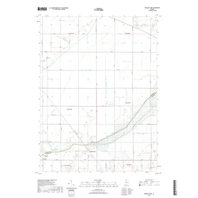
2019 Map of English Lake
USGS Topo · Published 2019About this map
The confluence of the Kankakee River and the Yellow River serves as the focal point of this landscape on the border of Starke and LaPorte counties. The settlement of English Lake sits just east of this junction, historically notable for its position within the vast marshlands that once dominated this region. While the modern topography is defined by a dense grid of drainage projects like the William Arm of Tuesburg Ditch, Marsh Ditch, and Davidson Drain, the remnant Old Channel Kankakee River and Bogus Run hint at the original meandering hydrology of the basin. Further west, the small communities of Archangels Landing and Lomax line the southern bank of the Kankakee. To the north, Saint Martins Cem serves as a lone local landmark amidst the agricultural fields and drainage arms, including the Hundt Ditch and Rosenbaum Arm, illustrating the extensive engineering required to manage this low-lying territory.
Find a feature on this map
52 named features on this map. Tap any name to fly to it.
Don’t see what you’re looking for? This feature index may not catch every label — zoom into the map to look around manually.
Map Details
Editions of this 2019 English Lake Map
This is the sole edition of this map. No revisions or reprints were ever made.
Other maps of this area

1953 · Wanatah
USGS Topo · 1:24,000

1953 · Chicago
USGS Topo · 1:250,000

1957 · Chicago
USGS Topo · 1:250,000

1957 · Knox West
USGS Topo · 1:24,000

1958 · La Crosse
USGS Topo · 1:24,000

1958 · Hanna
USGS Topo · 1:24,000

1958 · Kingsford Heights
USGS Topo · 1:24,000

1959 · English Lake
USGS Topo · 1:24,000

1959 · North Judson
USGS Topo · 1:24,000

1959 · San Pierre
USGS Topo · 1:24,000