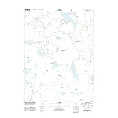
2012 Map of English Mountain
USGS Topo · Published 2012About this map
Baltimore Town sits at the southern edge of this high-elevation landscape, where historic mining and ranching interests shaped the upper reaches of the Middle Yuba River watershed. The terrain is defined by a dense concentration of alpine water bodies, including Sawmill Lake, French Lake, and the expansive Jackson Meadows Reservoir, connected by a network of forest routes like Meadow Lake Rd. Evidence of early industrial engineering is present in the Milton-Bowman Tunnel, which links distinct drainage basins across the granite ridges. High points like English Mountain and Haystack Mountain overlook a series of backcountry sites, from the established Ennors Ranch and English Mountain Ranch to numerous campgrounds such as Jackson Creek Campground and Faucherie Campground. This 2012 survey captures the region's transition from a resource-extraction frontier to a managed recreational wilderness, preserving the locations of legacy settlements and isolated landmarks like the Bent Monument.
Find a feature on this map
75 named features on this map. Tap any name to fly to it.
Don’t see what you’re looking for? This feature index may not catch every label — zoom into the map to look around manually.
Map Details
Editions of this 2012 English Mountain Map
This is the sole edition of this map. No revisions or reprints were ever made.
Other maps of this area

1890 · Sierraville
USGS Topo · 1:125,000

1891 · Downieville
USGS Topo · 1:125,000

1891 · Colfax
USGS Topo · 1:125,000

1891 · Truckee
USGS Topo · 1:125,000

1892 · Sierraville
USGS Topo · 1:125,000

1892 · Colfax
USGS Topo · 1:125,000

1893 · Truckee
USGS Topo · 1:125,000

1893 · Downieville
USGS Topo · 1:125,000

1894 · Colfax
USGS Topo · 1:125,000

1894 · Sierraville
USGS Topo · 1:125,000