
1951 Map of English
USGS Topo · Published 1951About this map
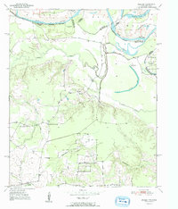
The Red River defines the shifting border between Texas and Oklahoma in this mid-century survey, creating a landscape of active and abandoned river channels. Numerous oxbows and cut-offs, such as Eagle Bend Cut-off and Forty-one cut-off Lake, illustrate the river's historical migration through the floodplain. Inland from the river, the settlement of English serves as a hub for a rural community characterized by established civic institutions.
Find a feature on this map
23 named features on this map. Tap any name to fly to it.
Don’t see what you’re looking for? This feature index may not catch every label — zoom into the map to look around manually.
Map Details
Editions of this 1951 English Map
2 editions found
Other maps of this area

1950 · Acworth
USGS Topo · 1:24,000

1950 · De Kalb NW
USGS Topo · 1:24,000

1950 · White Rock
USGS Topo · 1:24,000

1950 · Haworth
USGS Topo · 1:24,000

1950 · Oak Grove
USGS Topo · 1:24,000

1950 · Annona
USGS Topo · 1:24,000

1951 · Idabel SE
USGS Topo · 1:24,000

1951 · Annona
USGS Topo · 1:24,000

1951 · White Rock
USGS Topo · 1:24,000

1951 · De Kalb NW
USGS Topo · 1:24,000