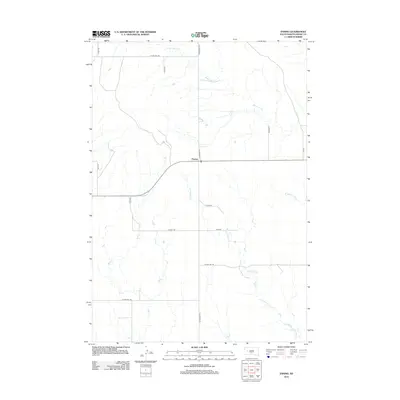
2012 Map of Enning
USGS Topo · Published 2012About this map
Enning sits as the central point of activity in this northern plains landscape, characterized by the drainage networks of several seasonal waterways. The settlement is anchored by its Po, located near the intersection of Razorback RD and the east-west corridor of South Dakota Highway 34. This 2012 survey illustrates a sparse but organized grid of county roads and avenues that connect isolated homesteads across the grasslands. The hydrology of the region is defined by the winding paths of White Owl Cr in the north and the extensive reach of Bull Cr to the southwest. To the southeast, the drainage of E Killdeer Cr and W Badlands Cr suggests the more complex, eroded terrain typical of the Meade County ranching country.
Find a feature on this map
19 named features on this map. Tap any name to fly to it.
Don’t see what you’re looking for? This feature index may not catch every label — zoom into the map to look around manually.
Map Details
Editions of this 2012 Enning Map
This is the sole edition of this map. No revisions or reprints were ever made.
Other maps of this area

1953 · Rapid City
USGS Topo · 1:250,000

1954 · Dalzell NW
USGS Topo · 1:24,000

1954 · Haydraw
USGS Topo · 1:24,000

1954 · Boneita Springs
USGS Topo · 1:24,000

1957 · Rapid City
USGS Topo · 1:250,000

1959 · Enning
USGS Topo · 1:24,000

1959 · Redowl
USGS Topo · 1:24,000

1959 · Stoneville
USGS Topo · 1:24,000

1959 · Union Center
USGS Topo · 1:24,000

1983 · Whiteman Owl NW
USGS Topo · 1:24,000