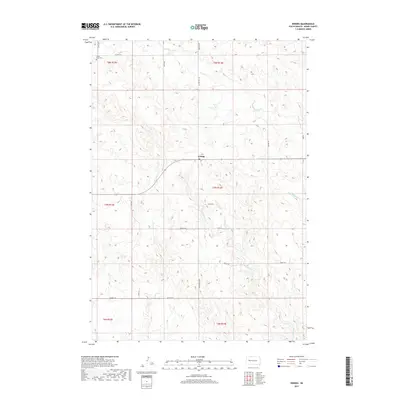
2017 Map of Enning
USGS Topo · Published 2017About this map
The unincorporated community of Enning serves as the central hub of this Meade County landscape, situated at the junction of several key rural routes. This modern survey illustrates the expansive drainage systems of the western plains, defined by the winding paths of White Owl Cr to the north and the divergent flows of W Badlands Cr and E Killdeer Cr to the east and south. A notable landmark for local history and genealogy is the Chalk Butte Cem, located in the northwest corner near Co Hwy 22 S. The map reflects a highly organized rural infrastructure, where long-established section lines and ranching roads like Reinert Rd and Ranch Rd connect isolated homesteads across the townships of T7N R13E and T8N R13E.
Find a feature on this map
27 named features on this map. Tap any name to fly to it.
Don’t see what you’re looking for? This feature index may not catch every label — zoom into the map to look around manually.
Map Details
Editions of this 2017 Enning Map
This is the sole edition of this map. No revisions or reprints were ever made.
Other maps of this area

1953 · Rapid City
USGS Topo · 1:250,000

1954 · Dalzell NW
USGS Topo · 1:24,000

1954 · Haydraw
USGS Topo · 1:24,000

1954 · Boneita Springs
USGS Topo · 1:24,000

1957 · Rapid City
USGS Topo · 1:250,000

1959 · Enning
USGS Topo · 1:24,000

1959 · Redowl
USGS Topo · 1:24,000

1959 · Stoneville
USGS Topo · 1:24,000

1959 · Union Center
USGS Topo · 1:24,000

1983 · Whiteman Owl NW
USGS Topo · 1:24,000