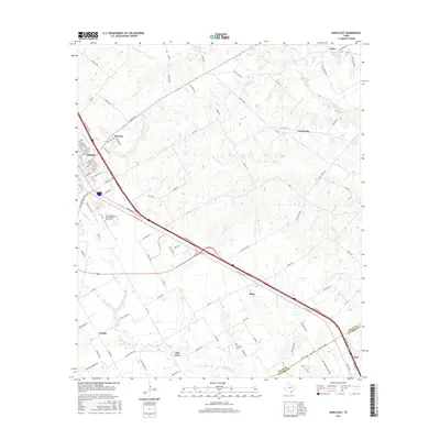
2016 Map of Ennis East
USGS Topo · Published 2016About this map
The southeastern edge of Ennis serves as the focal point for this survey, where Interstate 45 and U.S. Route 287 intersect to form a major transportation corridor through the Texas blackland prairies. The landscape is characterized by a series of small, dispersed settlements including Sonoma, Alma, and Rice, which sit along the primary transit lines. These communities are linked by an extensive network of farm-to-market roads and local lanes such as Old Telico Rd and Section Hse Rd, reflecting a rural economy anchored by well-established property lines and family landholdings.
Find a feature on this map
97 named features on this map. Tap any name to fly to it.
Don’t see what you’re looking for? This feature index may not catch every label — zoom into the map to look around manually.
Map Details
Editions of this 2016 Ennis East Map
This is the sole edition of this map. No revisions or reprints were ever made.
Other maps of this area

1954 · Dallas
USGS Topo · 1:250,000

1956 · Ennis
USGS Topo · 1:62,500

1958 · Dallas
USGS Topo · 1:250,000

1961 · Chatfield
USGS Topo · 1:24,000

1962 · Emhouse
USGS Topo · 1:24,000

1962 · Ennis West
USGS Topo · 1:24,000

1962 · Ennis East
USGS Topo · 1:24,000

1962 · Rosser SW
USGS Topo · 1:24,000

1962 · Cryer Creek
USGS Topo · 1:24,000
1962 · Bristol
USGS Topo · 1:24,000