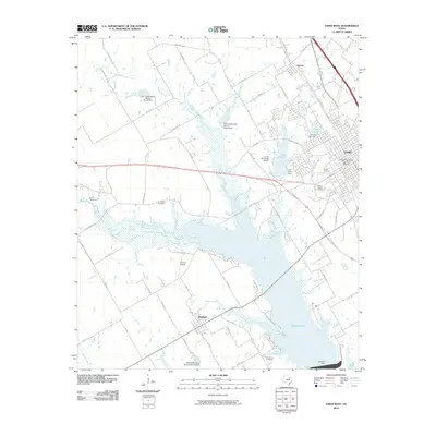
2010 Map of Ennis West
USGS Topo · Published 2010About this map
The Ennis Commercial Historic District anchors the eastern edge of this landscape, reflecting a century of growth in Ellis County. This 2010 survey shows the developed streets of Ennis transitioning into the broader agricultural and water management systems of the Texas blackland prairies. The western half is defined by a series of critical water control structures, including the Soil Conservation Service Site 19 Dam and Site 20 Dam along Mustang Creek, which feed into the extensive wetlands of Waxahachie Creek.
Find a feature on this map
66 named features on this map. Tap any name to fly to it.
Don’t see what you’re looking for? This feature index may not catch every label — zoom into the map to look around manually.
Map Details
Editions of this 2010 Ennis West Map
This is the sole edition of this map. No revisions or reprints were ever made.
Other maps of this area

1954 · Dallas
USGS Topo · 1:250,000

1956 · Ennis
USGS Topo · 1:62,500

1958 · Dallas
USGS Topo · 1:250,000

1961 · Forreston
USGS Topo · 1:24,000
1961 · Waxahachie
USGS Topo · 1:24,000

1962 · Emhouse
USGS Topo · 1:24,000

1962 · Ennis West
USGS Topo · 1:24,000

1962 · Ennis East
USGS Topo · 1:24,000

1962 · Cryer Creek
USGS Topo · 1:24,000
1962 · Bristol
USGS Topo · 1:24,000