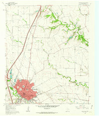
1961 Map of Waxahachie
USGS Topo · Published 1963About this map
The city of Waxahachie serves as the focal point of this 1961 survey, where the convergence of the Missouri Kansas Texas and Southern Pacific railroads defined the local economy and urban layout. Educational and social institutions are prominent, including the Southwestern Bible Institute, the Jack Coesie Childrens Home, and a dedicated Orphanage. The map also captures the expansion of the modern highway system with Interstate 35E and U S 77 running parallel through the landscape, cutting north toward Sterrett.
Find a feature on this map
49 named features on this map. Tap any name to fly to it.
Don’t see what you’re looking for? This feature index may not catch every label — zoom into the map to look around manually.
Map Details
Editions of this 1961 Waxahachie Map
Other maps of this area

1891 · Dallas
USGS Topo · 1:125,000

1893 · Dallas
USGS Topo · 1:125,000

1954 · Dallas
USGS Topo · 1:250,000

1956 · Ennis
USGS Topo · 1:62,500

1958 · Dallas
USGS Topo · 1:250,000

1959 · Lancaster
USGS Topo · 1:24,000

1959 · Cedar Hill
USGS Topo · 1:24,000

1959 · Ferris
USGS Topo · 1:24,000

1959 · Seagoville
USGS Topo · 1:62,500

1960 · Boz
USGS Topo · 1:24,000