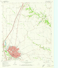
1961 Map of Waxahachie
USGS Topo · Published 1973About this map
Waxahachie serves as the focal point of this 1961 survey, showing a bustling Texas county seat defined by its crossroads of rail and road. The city is deeply detailed, featuring the Courthouse, Post Office, and a concentrated network of schools including Marvin Sch, Oak Lawn Sch, and the Southwestern Bible Institute. Beyond the urban center, the landscape transitions into agricultural land dotted with local institutions like the Orphanage and the Jack Coes Childrens Home. The infrastructure of the era is represented by the County Airport and the County Farm, while recreation is found at the Golf Course and Getzendaner Memorial Park.
Find a feature on this map
45 named features on this map. Tap any name to fly to it.
Don’t see what you’re looking for? This feature index may not catch every label — zoom into the map to look around manually.
Map Details
Editions of this 1961 Waxahachie Map
Other maps of this area

1891 · Dallas
USGS Topo · 1:125,000

1893 · Dallas
USGS Topo · 1:125,000

1954 · Dallas
USGS Topo · 1:250,000

1956 · Ennis
USGS Topo · 1:62,500

1958 · Dallas
USGS Topo · 1:250,000

1959 · Lancaster
USGS Topo · 1:24,000

1959 · Cedar Hill
USGS Topo · 1:24,000

1959 · Ferris
USGS Topo · 1:24,000

1959 · Seagoville
USGS Topo · 1:62,500

1960 · Boz
USGS Topo · 1:24,000