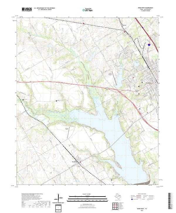
2022 Map of Ennis West
USGS Topo · Published 2022About this map
The expansive waters of Bardwell Lake dominate the southern half of this landscape, formed by the impoundment of Waxahachie Cr. The surrounding terrain reflects a blend of rural Texas heritage and suburban growth, with the city of Ennis established as a major regional hub in the eastern portion of the map. Smaller communities like Bardwell and Garrett provide additional points of historical reference along the local road network. Genealogists will find a significant concentration of burial sites throughout the area, including Boren Cem, Templeton Cem, and Myrtle Cem. The map also captures local aviation infrastructure with the Ennis Municipal Airport and Flying O Airport, while the northern reaches are defined by numerous drainage systems such as Mustang Cr and Wolf Br.
Find a feature on this map
140 named features on this map. Tap any name to fly to it.
Don’t see what you’re looking for? This feature index may not catch every label — zoom into the map to look around manually.
Map Details
Editions of this 2022 Ennis West Map
This is the sole edition of this map. No revisions or reprints were ever made.
Other maps of this area

1954 · Dallas
USGS Topo · 1:250,000

1956 · Ennis
USGS Topo · 1:62,500

1958 · Dallas
USGS Topo · 1:250,000

1961 · Forreston
USGS Topo · 1:24,000
1961 · Waxahachie
USGS Topo · 1:24,000

1962 · Emhouse
USGS Topo · 1:24,000

1962 · Ennis West
USGS Topo · 1:24,000

1962 · Ennis East
USGS Topo · 1:24,000

1962 · Cryer Creek
USGS Topo · 1:24,000
1962 · Bristol
USGS Topo · 1:24,000