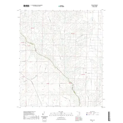
2021 Map of Enon
USGS Topo · Published 2021About this map
The Perdido River serves as the central geographic feature and political boundary between Alabama and Florida on this 2021 survey. The landscape is defined by the winding river corridor, which supports modern recreational infrastructure like the Perdido Canoe Trail - Section 1 Trl and the terrestrial Perdido Trl. On the Florida side, the settlement of Enon sits at the intersection of S Pineville Rd and Co Rd 97A.
Find a feature on this map
44 named features on this map. Tap any name to fly to it.
Don’t see what you’re looking for? This feature index may not catch every label — zoom into the map to look around manually.
Map Details
Editions of this 2021 Enon Map
This is the sole edition of this map. No revisions or reprints were ever made.
Other maps of this area

1920 · Robertsdale
USGS Topo · 1:62,500

1921 · Muscogee
USGS Topo · 1:62,500

1941 · Muscogee
USGS Topo · 1:62,500

1941 · Robertsdale
USGS Topo · 1:62,500

1941 · Century
USGS Topo · 1:62,500

1942 · Dyas
USGS Topo · 1:62,500

1943 · Robertsdale
USGS Topo · 1:62,500

1943 · Muscogee
USGS Topo · 1:62,500

1943 · Century
USGS Topo · 1:62,500

1944 · Dyas
USGS Topo · 1:62,500