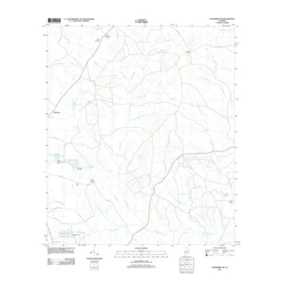
2011 Map of Enterprise NE
USGS Topo · Published 2011About this map
The Pea River Cemetery and Old Tabernacle Cemetery stand as quiet sentinels in the northern reaches of this Coffee County landscape, reflecting the long-established rural communities north of Enterprise. The terrain is defined by an intricate network of waterways, where names like Bruces Mill Creek, Kiser Mill Creek, and Blocks Mill Creek suggest a history of small-scale milling and local industry tied to the land. Near the center of the sheet, the Boy Scout camp, Camp Alaflo, is situated along the waters of Harris Mill Creek. Further south, more recent water management is evident at Pittman Brothers Lake and Gateway Lake, alongside the small settlement of Tabernacle. This 2011 survey documents a mix of traditional family burial grounds, including Ebenezer Cemetery and Wesley Chapel Cemetery, alongside modern infrastructure such as Parish Bridge and the various county roads that lace together these dispersed homesteads and woodlots.
Find a feature on this map
42 named features on this map. Tap any name to fly to it.
Don’t see what you’re looking for? This feature index may not catch every label — zoom into the map to look around manually.
Map Details
Editions of this 2011 Enterprise NE Map
This is the sole edition of this map. No revisions or reprints were ever made.
Other maps of this area

1942 · Enterprise
USGS Topo · 1:125,000

1948 · Ozark
USGS Topo · 1:62,500

1948 · Brundidge
USGS Topo · 1:62,500

1950 · Ozark
USGS Topo · 1:62,500

1950 · Enterprise
USGS Topo · 1:62,500

1950 · Brundidge
USGS Topo · 1:62,500

1953 · Dothan
USGS Topo · 1:250,000

1954 · Dothan
USGS Topo · 1:250,000

1955 · Dothan
USGS Topo · 1:250,000

1960 · Brundidge SE
USGS Topo · 1:24,000