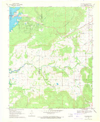
1969 Map of Enterprise
USGS Topo · Published 1971About this map
Eufaula Reservoir dominates the northwestern corner of this landscape at the intersection of Pittsburg and Haskell counties. The shoreline includes the Highway 9 Landing, a campground, and a picnic area, signaling the area's transition into a mid-century recreational destination. To the east, the terrain rises sharply toward Brooken Mountain and Beaver Mountain, where the settlement of Enterprise is situated near the Enterprise Cem and the Ware Farm Landing Field.
Find a feature on this map
26 named features on this map. Tap any name to fly to it.
Don’t see what you’re looking for? This feature index may not catch every label — zoom into the map to look around manually.
Map Details
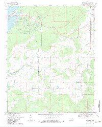
Editions of this 1969 Enterprise Map
2 editions found
Other maps of this area

1900 · Sansbois
USGS Topo · 1:125,000

1900 · Canadian
USGS Topo · 1:125,000

1909 · Sans Bois
USGS Topo · 1:125,000

1911 · Sansbois
USGS Topo · 1:125,000

1946 · Fort Smith
USGS Topo · 1:250,000

1963 · Porum
USGS Topo · 1:24,000

1963 · Eufaula
USGS Topo · 1:24,000

1963 · Texanna
USGS Topo · 1:24,000

1965 · Fort Smith
USGS Topo · 1:250,000

1967 · Fort Smith
USGS Topo · 1:250,000