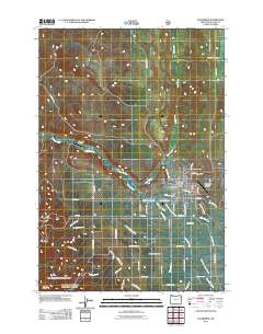
2011 Map of Enterprise
USGS Topo · Published 2011About this map
The settlement of Enterprise serves as the focal point of this Wallowa County landscape, situated where the Wallowa River meets a network of vital irrigation systems. The map details a sophisticated water management network essential for local agriculture, including the Island Ditch, Hurricane Ditch, and several branches of the Alder Slope Ditch. These waterways weave through a valley floor defined by rural development, connecting the main town with outlying areas like Freels.
Find a feature on this map
53 named features on this map. Tap any name to fly to it.
Don’t see what you’re looking for? This feature index may not catch every label — zoom into the map to look around manually.
Map Details
Editions of this 2011 Enterprise Map
This is the sole edition of this map. No revisions or reprints were ever made.
Other maps of this area

1955 · Grangeville
USGS Topo · 1:250,000

1957 · Enterprise
USGS Topo · 1:62,500

1957 · Joseph
USGS Topo · 1:62,500

1957 · Sled Springs
USGS Topo · 1:62,500

1957 · Elk Mountain
USGS Topo · 1:62,500

1959 · Grangeville
USGS Topo · 1:250,000

1982 · Wallowa
USGS Topo · 1:100,000

1986 · Enterprise
USGS Topo · 1:100,000

1990 · Lostine
USGS Topo · 1:24,000

1990 · Chief Joseph Mtn
USGS Topo · 1:24,000