
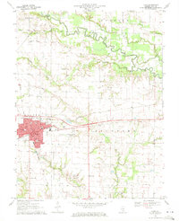
1970 Map of Enterprise
USGS Topo · Published 1971About this map
The Little Wabash River and its major tributaries, the Elm River and Stanford Creek, define this 1970 landscape along the border of Clay and Wayne Counties. The region is characterized by small rural settlements and a significant petroleum footprint, most notably the Clay City Oil Field which spans across much of the northern and central sections. This industrial presence contrasts with the density of small, family-named burial grounds and country churches that reflect the area's agricultural genealogy.
Find a feature on this map
26 named features on this map. Tap any name to fly to it.
Don’t see what you’re looking for? This feature index may not catch every label — zoom into the map to look around manually.
Map Details
Editions of this 1970 Enterprise Map
This is the sole edition of this map. No revisions or reprints were ever made.
Other maps of this area

1943 · Albion
USGS Topo · 1:62,500

1946 · Albion
USGS Topo · 1:62,500

1948 · Fairfield
USGS Topo · 1:62,500

1948 · Flora
USGS Topo · 1:62,500

1949 · Olney
USGS Topo · 1:62,500

1949 · Flora
USGS Topo · 1:62,500

1958 · Belleville
USGS Topo · 1:250,000

1962 · Belleville
USGS Topo · 1:250,000

1970 · Clay City
USGS Topo · 1:24,000
1970 · Flora
USGS Topo · 1:24,000