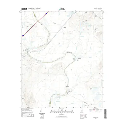
2014 Map of Epes East
USGS Topo · Published 2014About this map
The Tombigbee River carves a winding path through this corner of the Alabama Black Belt, defining the boundary between Sumter and Greene counties. The landscape is characterized by a complex network of river features and named bars, such as Epes Bar, Santos Bar, and Belfast Bar, which reflect the historic importance of the river for navigation. Near the town of Epes, the Gorgas Bridge spans the water at Jones Bluff, overlooking the Jones Bluff Shoals. To the north, the settlement of Boligee serves as a local hub, surrounded by numerous small family and community burial sites including Bethsalem Cem, Mt Bethel Cem, and Saint Luke Cem. Significant water management is evident through features like The Canal and various named reservoirs such as Sprees Twenty Acre Lake and the W D Johnston Lake system.
Find a feature on this map
77 named features on this map. Tap any name to fly to it.
Don’t see what you’re looking for? This feature index may not catch every label — zoom into the map to look around manually.
Map Details
Editions of this 2014 Epes East Map
This is the sole edition of this map. No revisions or reprints were ever made.
Other maps of this area

1927 · Eutaw
USGS Topo · 1:48,000

1929 · Epes
USGS Topo · 1:48,000

1931 · Eutaw
USGS Topo · 1:62,500

1932 · Epes
USGS Topo · 1:62,500

1947 · Forkland
USGS Topo · 1:24,000

1948 · Mc Dowell
USGS Topo · 1:24,000

1949 · Mc Dowell
USGS Topo · 1:24,000

1949 · Forkland
USGS Topo · 1:24,000

1953 · Montgomery
USGS Topo · 1:250,000

1953 · Meridian
USGS Topo · 1:250,000