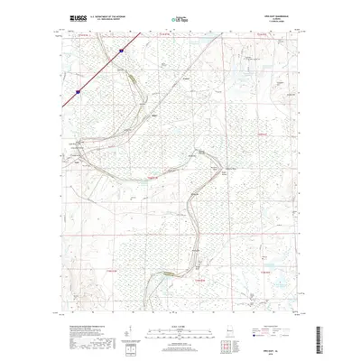
2018 Map of Epes East
USGS Topo · Published 2018About this map
The Tennessee-Tombigbee Waterway defines the western border of Greene County, winding past a series of named sandbars and bluffs that testify to the river's historic navigation challenges. Along this stretch of water, landmarks like Jones Bluff Shoals and Gorgas Bridge near the town of Epes mark the crossing points between Sumter and Greene counties. The landscape is heavily shaped by both natural and man-made hydrology, from the intricate wetlands of Boligee Cr and Gums Pond Slough to the numerous private lakes such as W D Johnston Lake Number 2. Genealogists will find a high density of rural burial grounds scattered across the terrain, including Bethsalem Cem, Saint Luke Cem, and Mount Pilgrim Cem, many associated with small settlements like Miller and Fowler.
Find a feature on this map
88 named features on this map. Tap any name to fly to it.
Don’t see what you’re looking for? This feature index may not catch every label — zoom into the map to look around manually.
Map Details
Editions of this 2018 Epes East Map
This is the sole edition of this map. No revisions or reprints were ever made.
Other maps of this area

1927 · Eutaw
USGS Topo · 1:48,000

1929 · Epes
USGS Topo · 1:48,000

1931 · Eutaw
USGS Topo · 1:62,500

1932 · Epes
USGS Topo · 1:62,500

1947 · Forkland
USGS Topo · 1:24,000

1948 · Mc Dowell
USGS Topo · 1:24,000

1949 · Mc Dowell
USGS Topo · 1:24,000

1949 · Forkland
USGS Topo · 1:24,000

1953 · Montgomery
USGS Topo · 1:250,000

1953 · Meridian
USGS Topo · 1:250,000