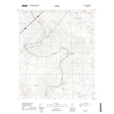
2020 Map of Epes East
USGS Topo · Published 2020About this map
The Tennessee-Tombigbee Waterway defines the western edge of this landscape, carving through the terrain where Sumter and Greene counties meet. The river's winding path is punctuated by numerous bars and shoals, including Millers Bar, Belfast Bar, and the notable Jones Bluff Shoals. Near the settlement of Epes, the Gorgas Bridge carries traffic over the water, while the Port of Epes Hwy serves the industrial and transport needs of the river valley.
Find a feature on this map
84 named features on this map. Tap any name to fly to it.
Don’t see what you’re looking for? This feature index may not catch every label — zoom into the map to look around manually.
Map Details
Editions of this 2020 Epes East Map
This is the sole edition of this map. No revisions or reprints were ever made.
Other maps of this area

1927 · Eutaw
USGS Topo · 1:48,000

1929 · Epes
USGS Topo · 1:48,000

1931 · Eutaw
USGS Topo · 1:62,500

1932 · Epes
USGS Topo · 1:62,500

1947 · Forkland
USGS Topo · 1:24,000

1948 · Mc Dowell
USGS Topo · 1:24,000

1949 · Mc Dowell
USGS Topo · 1:24,000

1949 · Forkland
USGS Topo · 1:24,000

1953 · Montgomery
USGS Topo · 1:250,000

1953 · Meridian
USGS Topo · 1:250,000