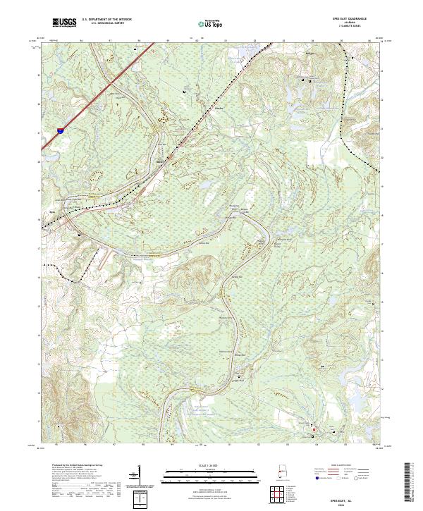
2024 Map of Epes East
USGS Topo · Published 2024About this map
The Tennessee-Tombigbee Waterway and the winding Tombigbee River define the boundary between Greene and Sumter counties, creating a landscape shaped by river transport and floodplain deposits. The geography is marked by numerous river features including Hayes Bar, Santos Bar, and Belfast Bar, alongside high points like McAlpine Bluff and Jones Bluff. This modern record of the corridor preserves the locations of vital historical river crossings like Martans Ferry, McAlpines Ferry, and Hillman Ferry, illustrating how the waterway remained a primary conduit for movement long after the establishment of settlements like Boligee and Epes.
Find a feature on this map
93 named features on this map. Tap any name to fly to it.
Don’t see what you’re looking for? This feature index may not catch every label — zoom into the map to look around manually.
Map Details
Editions of this 2024 Epes East Map
This is the sole edition of this map. No revisions or reprints were ever made.
Other maps of this area

1927 · Eutaw
USGS Topo · 1:48,000

1929 · Epes
USGS Topo · 1:48,000

1931 · Eutaw
USGS Topo · 1:62,500

1932 · Epes
USGS Topo · 1:62,500

1947 · Forkland
USGS Topo · 1:24,000

1948 · Mc Dowell
USGS Topo · 1:24,000

1949 · Mc Dowell
USGS Topo · 1:24,000

1949 · Forkland
USGS Topo · 1:24,000

1953 · Montgomery
USGS Topo · 1:250,000

1953 · Meridian
USGS Topo · 1:250,000