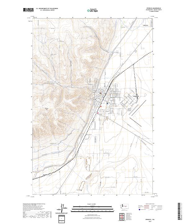
2023 Map of Ephrata
USGS Topo · Published 2023About this map
The city of Ephrata serves as a focal point in this Central Washington landscape, where the flat, agricultural basin meets the dramatic rising slopes of the Beezley Hills. The town's layout is defined by its role as a regional hub, anchored by the Grant County Courthouse and supported by the Ephrata Municipal Airport to the southeast. Outside the residential blocks, the map reveals a complex irrigation network vital to the area's arid climate, featuring the West Canal, Quincy Lateral Canal, and Canal W 20.
Find a feature on this map
70 named features on this map. Tap any name to fly to it.
Don’t see what you’re looking for? This feature index may not catch every label — zoom into the map to look around manually.
Map Details
Editions of this 2023 Ephrata Map
This is the sole edition of this map. No revisions or reprints were ever made.