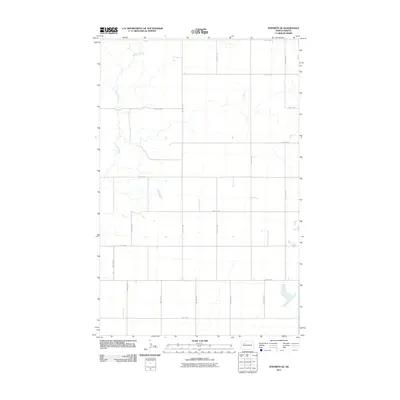
2011 Map of Epworth SE
USGS Topo · Published 2011About this map
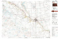
Shell Creek meanders through the northwest corner of this agricultural landscape in Mountrail County, serving as the primary natural drainage in an otherwise highly structured section-line grid. This 2011 survey by the U.S. Geological Survey illustrates a sparsely populated rural territory dominated by large-scale farming and the township-range system. The map is defined by a dense network of gravel and local roads, including 71st Ave NW and 41st St NW, which facilitate movement across the open plains. Small depressions and seasonal wetlands are scattered between the road intervals, particularly along 48th St NW, reflecting the prairie pothole geography typical of this region of North Dakota. For researchers and genealogists, the map provides a precise layout of modern land divisions and access routes within the Epworth SE quadrangle.
Find a feature on this map
20 named features on this map. Tap any name to fly to it.
Don’t see what you’re looking for? This feature index may not catch every label — zoom into the map to look around manually.
Map Details
Editions of this 2011 Epworth SE Map
This is the sole edition of this map. No revisions or reprints were ever made.
Other maps of this area

1953 · Williston
USGS Topo · 1:250,000
1953 · Watford City
USGS Topo · 1:250,000
1954 · Minot
USGS Topo · 1:250,000
1954 · McClusky
USGS Topo · 1:250,000

1957 · Williston
USGS Topo · 1:250,000
1957 · Watford City
USGS Topo · 1:250,000
1958 · McClusky
USGS Topo · 1:250,000
1958 · Minot
USGS Topo · 1:250,000
1967 · Watford City
USGS Topo · 1:250,000
1980 · Minot
USGS Topo · 1:100,000