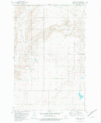
1981 Map of Epworth SE
USGS Topo · Published 1981About this map
Townhall stands as a focal point in this portion of Mountrail County, serving the rural community during the early 1980s. The landscape is defined by the headwaters and drainage of Shell Creek to the west and the pronounced incision of Spring Coulee to the east. This survey reveals a high-plains topography organized into distinct townships including Oakland, Osloe, Shell, and Model. The land use is primarily agricultural, marked by section-line roads and scattered infrastructure like a local Gravel Pit and a subterranean Pipeline cutting across the northern reaches. The numerous small potholes and depressions scattered across the terrain indicate the glacial heritage of the North Dakota prairie, while the presence of a centralized community hall suggests the enduring social organization of these rural townships in the late twentieth century.
Find a feature on this map
12 named features on this map. Tap any name to fly to it.
Don’t see what you’re looking for? This feature index may not catch every label — zoom into the map to look around manually.
Map Details
Editions of this 1981 Epworth SE Map
This is the sole edition of this map. No revisions or reprints were ever made.
Other maps of this area

1953 · Williston
USGS Topo · 1:250,000

1953 · Watford City
USGS Topo · 1:250,000

1954 · Minot
USGS Topo · 1:250,000

1954 · McClusky
USGS Topo · 1:250,000

1957 · Williston
USGS Topo · 1:250,000

1957 · Watford City
USGS Topo · 1:250,000

1958 · McClusky
USGS Topo · 1:250,000

1958 · Minot
USGS Topo · 1:250,000

1967 · Watford City
USGS Topo · 1:250,000

1980 · Minot
USGS Topo · 1:100,000