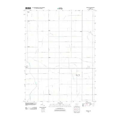
2010 Map of Erastus
USGS Topo · Published 2010About this map
Erastus and the surrounding Mercer County landscape appear here as a grid of agricultural land defined by a complex network of creeks and runs. The rural character of the area is emphasized by numerous small settlements and scattered country graveyards, such as the Landfair Cemetery and Buck Cemetery. A notable industrial presence is the Karch Stone Quarry, situated near the crossing of Beaver Creek and Karch Rd, representing the local extraction economy of western Ohio.
Find a feature on this map
56 named features on this map. Tap any name to fly to it.
Don’t see what you’re looking for? This feature index may not catch every label — zoom into the map to look around manually.
Map Details
Editions of this 2010 Erastus Map
This is the sole edition of this map. No revisions or reprints were ever made.
Other maps of this area

1908 · St. Henry
USGS Topo · 1:62,500

1911 · Berne
USGS Topo · 1:48,000

1914 · Celina
USGS Topo · 1:62,500

1915 · Fort Recovery
USGS Topo · 1:48,000

1918 · Fort Recovery
USGS Topo · 1:62,500

1944 · Celina
USGS Topo · 1:62,500

1953 · Muncie
USGS Topo · 1:250,000

1956 · Muncie
USGS Topo · 1:250,000

1960 · Fort Recovery
USGS Topo · 1:24,000
1960 · Celina
USGS Topo · 1:24,000