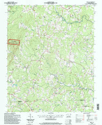
1994 Map of Erect
USGS Topo · Published 1998About this map
The Uwharrie National Forest and the State Zoological Park anchor the northern landscape of this Randolph County region, where the terrain is defined by the winding course of Richland Creek and its many Rapids. The map reveals a deeply established rural community structured around a dense network of country churches, including Needhams Grove Church, Union Grove Church, and Antioch Church. Small settlements like Erect and Jugtown are interconnected by winding secondary roads that follow the ridges between water bodies like Bachelor Creek and Little Creek.
Find a feature on this map
34 named features on this map. Tap any name to fly to it.
Don’t see what you’re looking for? This feature index may not catch every label — zoom into the map to look around manually.
Map Details
Editions of this 1994 Erect Map
This is the sole edition of this map. No revisions or reprints were ever made.
Other maps of this area

1942 · Troy
USGS Topo · 1:125,000

1953 · Raleigh
USGS Topo · 1:250,000

1954 · Raleigh
USGS Topo · 1:250,000

1957 · Troy
USGS Topo · 1:62,500

1957 · Asheboro
USGS Topo · 1:62,500

1968 · Ramseur
USGS Topo · 1:24,000

1968 · Coleridge
USGS Topo · 1:24,000

1968 · Erect
USGS Topo · 1:24,000

1968 · Bennett
USGS Topo · 1:24,000

1970 · Asheboro
USGS Topo · 1:24,000