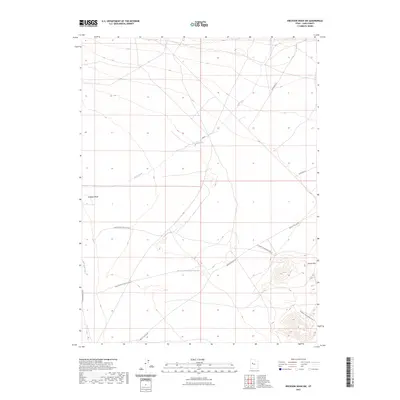
2023 Map of Erickson Wash SW
USGS Topo · Published 2023About this map
Desert Mtn anchors the southeastern corner of this landscape in Juab County, Utah. The terrain is defined by the remnants of prehistoric watercourses, most notably the Old River Bed and the intermittent drainage of Erickson Wash. These natural features dictate the path of several long-distance desert routes, including Jericho Callao Rd and Riverbed Ranch Rd, which navigate the arid flats.
Find a feature on this map
14 named features on this map. Tap any name to fly to it.
Don’t see what you’re looking for? This feature index may not catch every label — zoom into the map to look around manually.
Map Details
Editions of this 2023 Erickson Wash SW Map
This is the sole edition of this map. No revisions or reprints were ever made.
Other maps of this area

1885 · Sevier Desert
USGS Topo · 1:250,000

1953 · Delta
USGS Topo · 1:250,000

1955 · Indian Springs
USGS Topo · 1:24,000

1955 · Coyote Springs
USGS Topo · 1:24,000

1958 · Delta
USGS Topo · 1:250,000

1962 · Delta
USGS Topo · 1:250,000
1971 · Erickson Knoll
USGS Topo · 1:24,000

1971 · Desert Mtn Pass
USGS Topo · 1:24,000

1971 · Crater Bench Reservoir
USGS Topo · 1:24,000
1971 · Keg Mtn Ranch
USGS Topo · 1:24,000