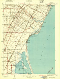
1943 Map of Erie
USGS Topo · Published 1943About this map
Lake Erie shoreline developments and intensive railway networks define this 1940s landscape along the Michigan-Ohio border. Five major rail lines, including the Pere Marquette and New York Central, converge toward the southern industrial hubs, slicing through the drainage-heavy terrain of La Salle and Erie. The map reveals a transition from inland agriculture to coastal recreation and maritime activity, evidenced by Toledo Beach, Bolles Harbor, and the residential growth at Luna Pier. Local infrastructure for rural families is well-documented through a dense concentration of neighborhood landmarks such as San Freal Sch, Sharkey Sch, and La Salle Cem. At the southern edge, the Michigan state line cuts across North Maumee Bay, situating Turtle Island and Guard Island at the maritime gateway to the region.
Find a feature on this map
81 named features on this map. Tap any name to fly to it.
Don’t see what you’re looking for? This feature index may not catch every label — zoom into the map to look around manually.
Map Details
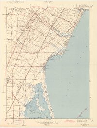
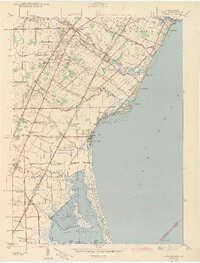
Editions of this 1943 Erie Map
3 editions found
Other maps of this area

1900 · Maumee Bay
USGS Topo · 1:62,500

1900 · Toledo
USGS Topo · 1:62,500

1912 · Monroe
USGS Topo · 1:62,500

1912 · Dundee
USGS Topo · 1:62,500

1914 · Monroe
USGS Topo · 1:62,500

1926 · Dundee
USGS Topo · 1:62,500

1927 · Monroe
USGS Topo · 1:31,680

1934 · Reno Beach
USGS Topo · 1:24,000

1934 · Point Place
USGS Topo · 1:24,000

1936 · Samaria
USGS Topo · 1:31,680
Featured Places
- Monroe Charter Township, MI
- LaSalle, LaSalle Township
- LaSalle Township, MI
- Erie, Erie Township
- Erie Township, MI