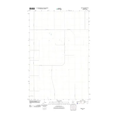
2010 Map of Erie NE
USGS Topo · Published 2010About this map
Beltrami County's northern landscape is defined by the rigid geometry of its road network, as shown in this 2010 topographic record. The area is dominated by the intersection of throughways such as Res Hwy 24 and Res Hwy 28, which serve as primary conduits through this section of the Minnesota wilderness. These roads, along with County Hwy-42 and County Hwy-28, represent the essential infrastructure supporting the scattered homes and farms in this sparsely settled region. The presence of smaller local routes like Sharon Rd NW and 75th Ave NE indicates the continued use and maintenance of the section-line grid system, providing clear documentation for researchers tracing property boundaries or 21st-century land use patterns in northern Minnesota.
Find a feature on this map
7 named features on this map. Tap any name to fly to it.
Don’t see what you’re looking for? This feature index may not catch every label — zoom into the map to look around manually.
Map Details
Editions of this 2010 Erie NE Map
This is the sole edition of this map. No revisions or reprints were ever made.
Other maps of this area

1918 · Malcolm
USGS Topo · 1:62,500

1918 · Jelle
USGS Topo · 1:62,500

1919 · Liner
USGS Topo · 1:62,500

1954 · Roseau
USGS Topo · 1:250,000

1957 · Roseau
USGS Topo · 1:250,000

1958 · Roseau
USGS Topo · 1:250,000

1972 · Erie
USGS Topo · 1:24,000
1972 · Good Lake
USGS Topo · 1:24,000
1973 · Grygla
USGS Topo · 1:24,000
1973 · Grygla SW
USGS Topo · 1:24,000