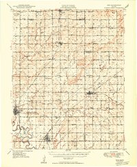
1949 Map of Erie
USGS Topo · Published 1949About this map
Neosho River meanders through the heart of this post-war landscape, anchoring a region defined by its productive plains and vital rail connections. The county seat at Erie and the town of St Paul serve as primary hubs, supported by a dense network of one-room schoolhouses like Wannersburg Sch and Pleasant Dale Sch. The era's transportation web is remarkably complete, featuring the crossing lines of the Atchison Topeka and Santa Fe, the Missouri Kansas and Texas, and the Missouri Pacific railroads.
Find a feature on this map
64 named features on this map. Tap any name to fly to it.
Don’t see what you’re looking for? This feature index may not catch every label — zoom into the map to look around manually.
Map Details
Editions of this 1949 Erie Map
3 editions found

Other maps of this area

1884 · Fort Scott
USGS Topo · 1:125,000

1886 · Joplin
USGS Topo · 1:125,000

1886 · Iola
USGS Topo · 1:125,000

1886 · Fort Scott
USGS Topo · 1:125,000

1886 · Parsons
USGS Topo · 1:125,000

1893 · Fort Scott
USGS Topo · 1:125,000

1893 · Iola
USGS Topo · 1:125,000

1893 · Parsons
USGS Topo · 1:125,000

1894 · Joplin
USGS Topo · 1:125,000

1904 · Iola
USGS Topo · 1:125,000