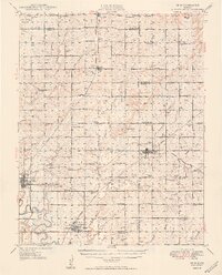
1949 Map of Erie
USGS Topo · Published 1949About this map
The Neosho River meanders through the heart of southeast Kansas, anchoring a landscape defined by its agricultural heritage and early energy development. This mid-century record documents the transition of the local economy, where established settlements like Erie and St Paul serve as central hubs for a dense network of one-room schoolhouses such as Independence Sch and Prairie View Sch. The proliferation of oil wells and a marked Oil Field south of Erie illustrate the region's industrial footprint alongside the persistent tracks of the Atchison Topeka and Santa Fe and the Missouri Kansas Texas railroads. These rail lines once fueled the growth of smaller communities like Savonburg, Stark, and Walnut, while the numerous rural cemeteries, including St Francis Cem and East Hill Cem, provide essential anchor points for genealogical research in Neosho and Crawford counties.
Find a feature on this map
64 named features on this map. Tap any name to fly to it.
Don’t see what you’re looking for? This feature index may not catch every label — zoom into the map to look around manually.
Map Details
Editions of this 1949 Erie Map
3 editions found

Other maps of this area

1884 · Fort Scott
USGS Topo · 1:125,000

1886 · Joplin
USGS Topo · 1:125,000

1886 · Iola
USGS Topo · 1:125,000

1886 · Fort Scott
USGS Topo · 1:125,000

1886 · Parsons
USGS Topo · 1:125,000

1893 · Fort Scott
USGS Topo · 1:125,000

1893 · Iola
USGS Topo · 1:125,000

1893 · Parsons
USGS Topo · 1:125,000

1894 · Joplin
USGS Topo · 1:125,000

1904 · Iola
USGS Topo · 1:125,000