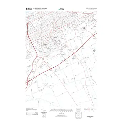
2013 Map of Erie South
USGS Topo · Published 2013About this map
Lake Erie defines the northern edge of this urban and suburban landscape, where the waters of Mill Creek and Walnut Creek flow toward the Great Lakes. This 2013 survey captures the dense street grid of southern Erie as it gives way to residential developments like Glenwood and Chestnut Hill. The presence of the Mill Creek Tube reflects significant local engineering efforts to manage the city's waterways. To the south, the landscape opens into varied recreational and community spaces, including the Glenwood Park Zoo and the Erie Municipal Golf Course. Historically significant nodes like Dock Junction and Kearsarge are clearly marked, showing the evolution of these former transport and settlement hubs into the modern suburban fabric. The map also traces the headwaters of LeBoeuf Creek and Elk Creek, marking the divide between the lake drainage and the southern interior.
Find a feature on this map
346 named features on this map. Tap any name to fly to it.
Don’t see what you’re looking for? This feature index may not catch every label — zoom into the map to look around manually.
Map Details
Editions of this 2013 Erie South Map
This is the sole edition of this map. No revisions or reprints were ever made.
Other maps of this area

1899 · Erie
USGS Topo · 1:62,500

1900 · Erie
USGS Topo · 1:62,500

1913 · North East
USGS Topo · 1:62,500

1915 · North East
USGS Topo · 1:62,500

1923 · Cambridge Springs
USGS Topo · 1:62,500

1925 · Cambridge Springs
USGS Topo · 1:62,500

1929 · Union City
USGS Topo · 1:62,500

1932 · Union City
USGS Topo · 1:62,500

1943 · North East
USGS Topo · 1:62,500

1943 · Cambridge Springs
USGS Topo · 1:62,500